
Ngari, Tibet (西藏阿里) 3
Burang – Menshi (Tirthapuri Monastery) – Zanda – Guge Kingdom Ruins – Shiquanhe – Pangong Tso
普蘭 – 門士鄉 (直達布日寺) – 扎達 – 古格王朝遺址 – 獅泉河 – 班公措
Before I begin my part two of the journey, you probably notice that I have updated the title from Ali to Ngari. Ali is the Chinese pinyin version and I have decided to align all the place names in Tibetan phonetics, hence changing it to Ngari. Sorry about the confusion.
From Lake Manasarovar (瑪旁雍措), we headed south for 66 kilometres to reach Burang (普蘭). Despite the short distance, it took us two hours to get there, as the dirt trail was bumpy. We were glad to descend back to 3,900m and decided to stay a few days in this small but historically and geographically strategic town.
Burang (普蘭) is close to the border with India and Nepal and is cradled in the western part of the Himalayas, Mount Naimona Nyi and Mount Api (the most northwest corner of Nepal). But unlike Gyirong (吉隆溝) which also lies next to Nepal, Burang (普蘭) is less developed and has an interesting mix of the old and new.
At first glimpse, it looked similar to any other small Tibetan towns – the main street lined with mediocre looking guesthouses, small restaurants, Tibetan teahouses and local shops. Then we turned into a narrow alley from the main street and suddenly we found ourselves in the middle of a cluster of shanties and make-shift shops selling Nepalese souvenirs, silver and daily knickknacks. It was the Nepalese market which looked quite different from the rest of the town.

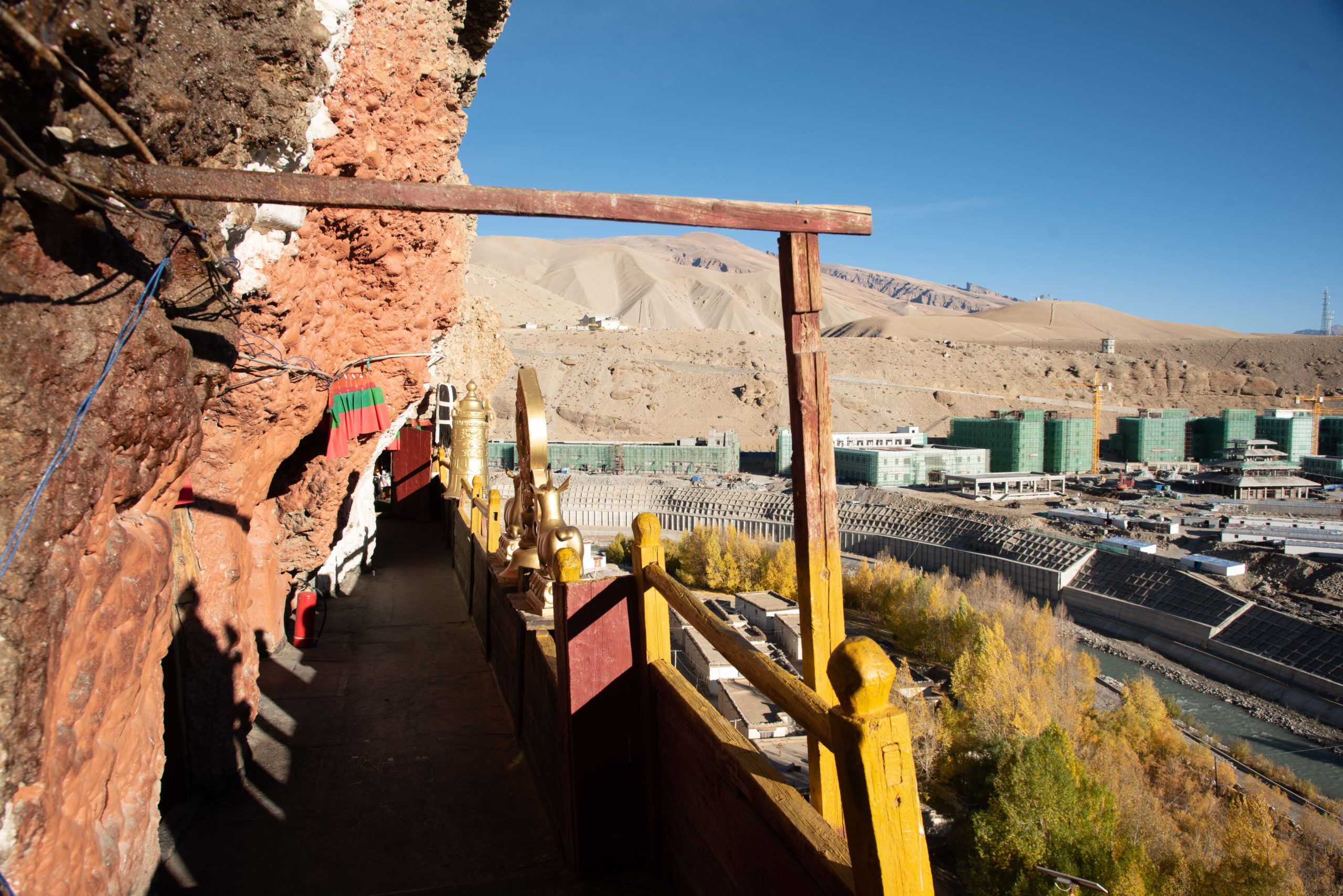
About 1.5 kilometre from the town centre across the other side of the Peacock River (孔雀河) is where the old town lies. There are ancient cave dwellings in the hill and deserted houses at the foot of the hill. Burang (普蘭) was originally the capital during the early period of the Guge Kingdom (古格王朝) founded by the great grandson of Langdarma (朗達瑪), the last king of the Tibetan Empire in the 10th century.

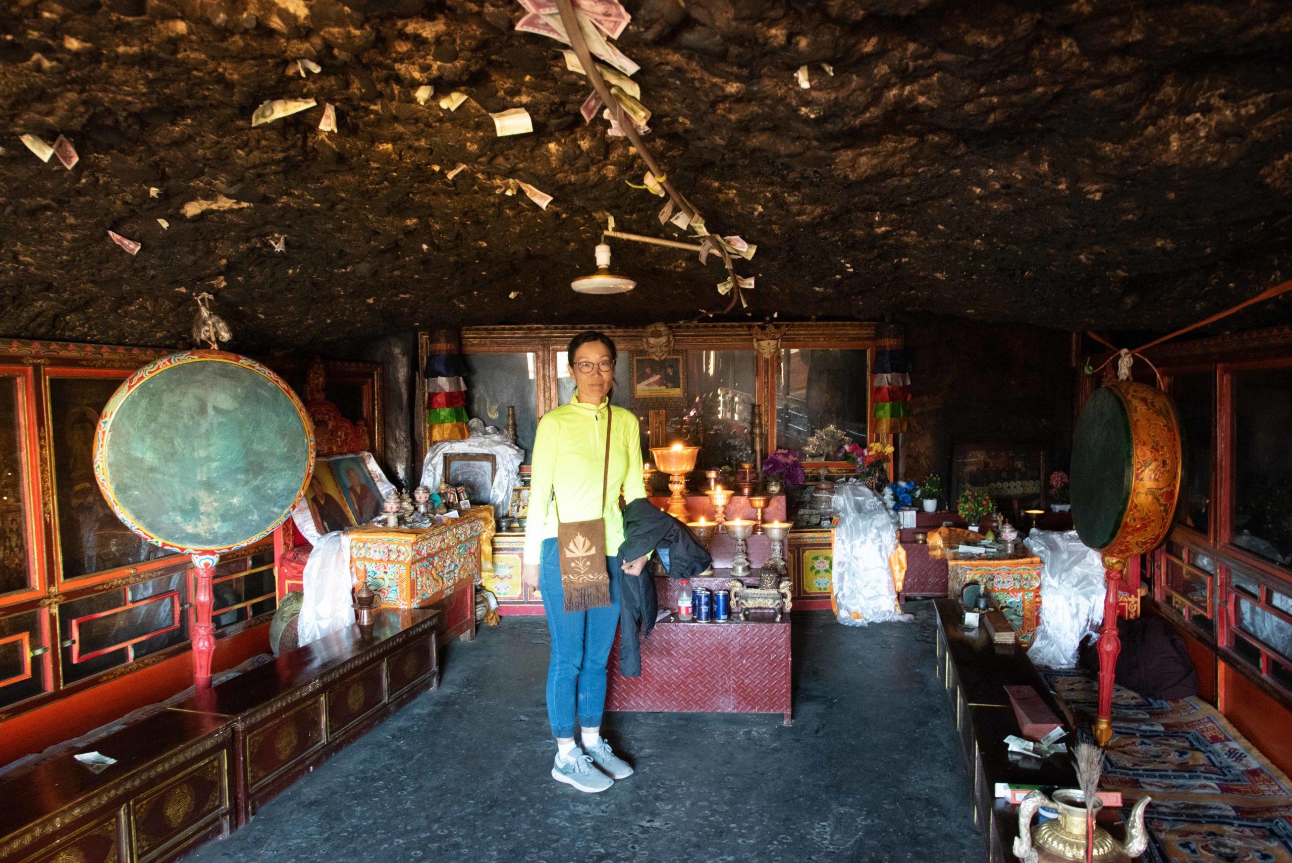
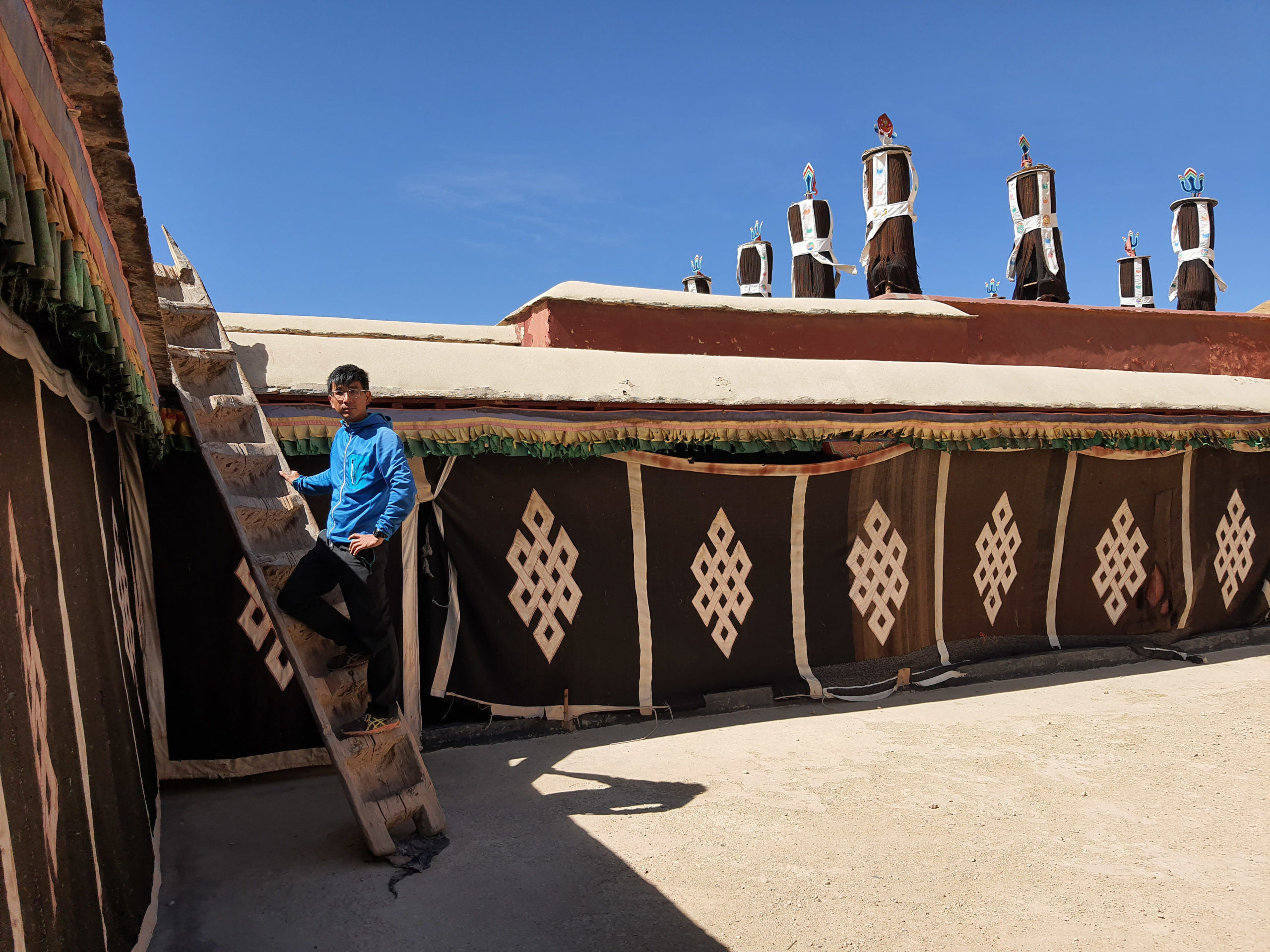
We walked up to the Old Palace Temple (古宮寺) which is carved out of the hill with hanging wooden balconies that looks so rickety that a sign is put up to warn visitors that no more than four people are allowed to go up at the same time. We climbed up some very narrow and steep steps to reach the different small caves on two levels of the temple. The temple is over a thousand years old and when I stepped foot on the balcony, I could not help holding my breath as the wooden planks squeaked and quivered under my shoes. The caves are so dark as their ceilings are smoked to pitch black by yak candles that I did not see them until the caretaker pointed them out.


After seeing the temple, we walked further uphill and saw the hillside honeycombed with cave dwellings. I read that a few of these caves are still inhabited by some monks to meditate. We reached the top of the hill where the remnants of another temple and the fortress stand. As we stood there taking in the panoramic view of the town and the snow mountains further beyond, I tried to imagine the lives of the monks and people during the Guge period (古格王朝). We saw two men working on the renovation and we bumped into them again when we walked down. They gave us a lift back to town. They are from Sichuan and they told us that they would return home in late October when it gets too cold to work.

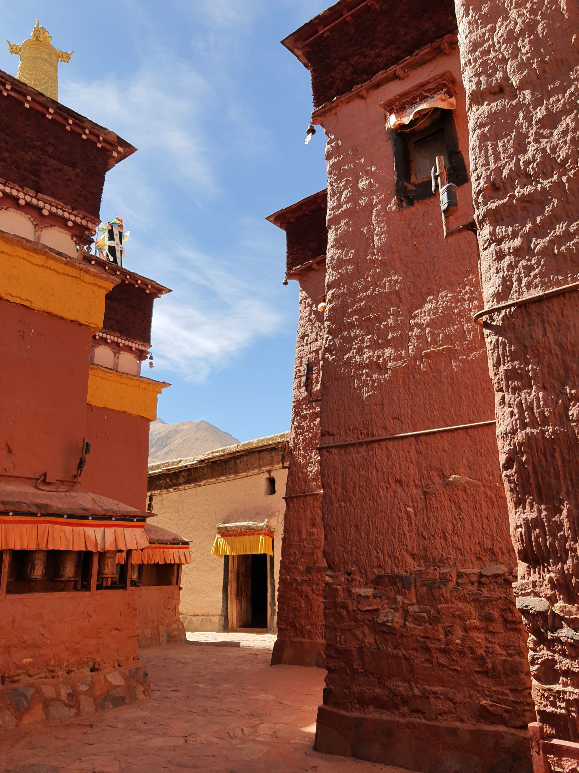
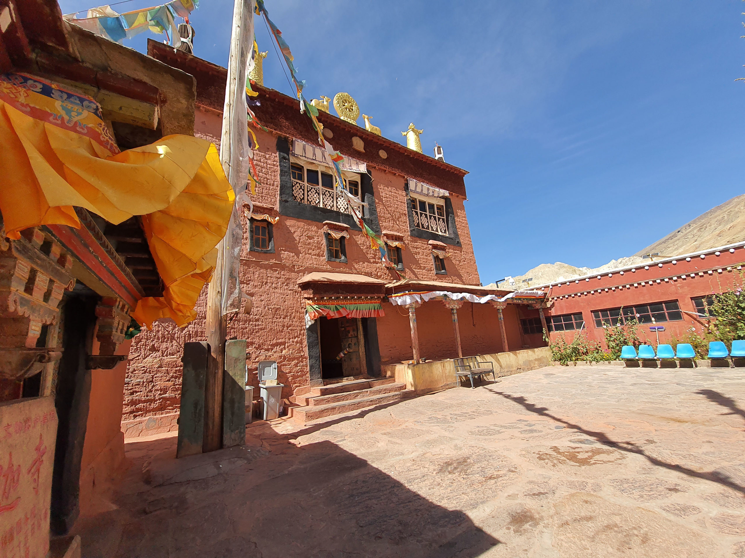
On the third day, we drove to the Khorzhak Monastery (科迦寺) 17 kilometres southeast of Burang (普蘭) in the small Khorzhak village (科迦村) right next to the border of India. Although it is small, the monastery is well known in the western part of Tibet, as travellers from India had to pass through here to reach Burang (普蘭) in the old days.
After a four-day stay in Burang (普蘭), we continued north-westward towards Zanda (扎達). We saw Mount Kailash (岡仁波齊神山) again on the way and stopped briefly at the Tirthapuri Monastery (直達布日寺) just outside the village called Menshi (門士鄉) where we saw a number of pilgrims doing prostrations (跪長頭) towards the temple.


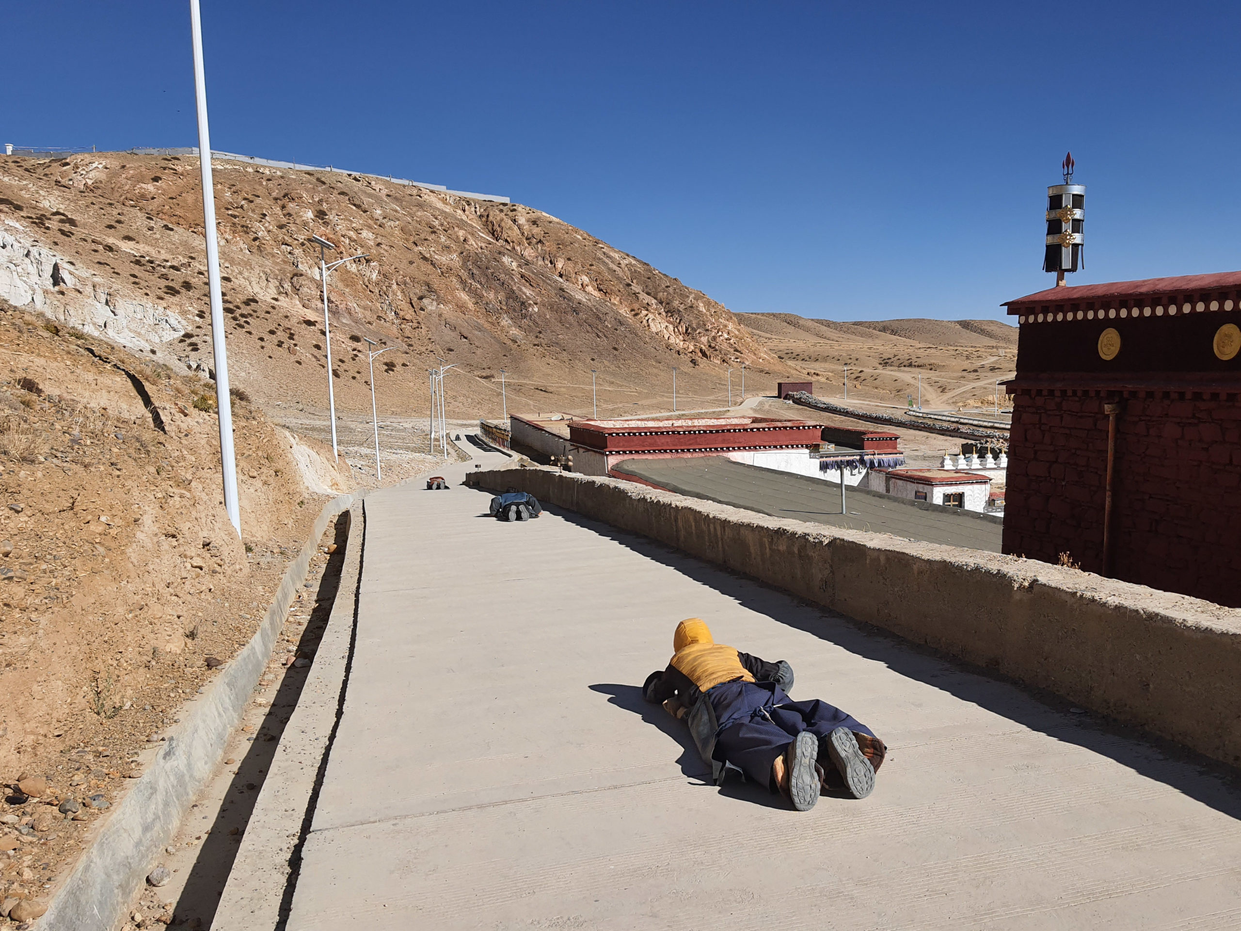
Tibetans are very devoted to their religious beliefs and many go on long-distance pilgrimage to Jokhang Temple (大眧寺) in Lhasa, Mount Kailash (岡仁波齊神山) and Lake Manasarovar (瑪旁雍措) by performing full-body prostrations all the way from their remote homes.

On our way to Lhasa (拉薩), we saw pilgrims prostrated on the side of the road. It would take them months to complete the pilgrimage. The thick and dark callus on their foreheads bear witness to such an arduous practice. Whenever they need to rest or sleep at night, they would make a mark at where the last prostration is and then return to the mark to continue. I admire their devotion on one hand but their utter determination is also something beyond my secular comprehension.
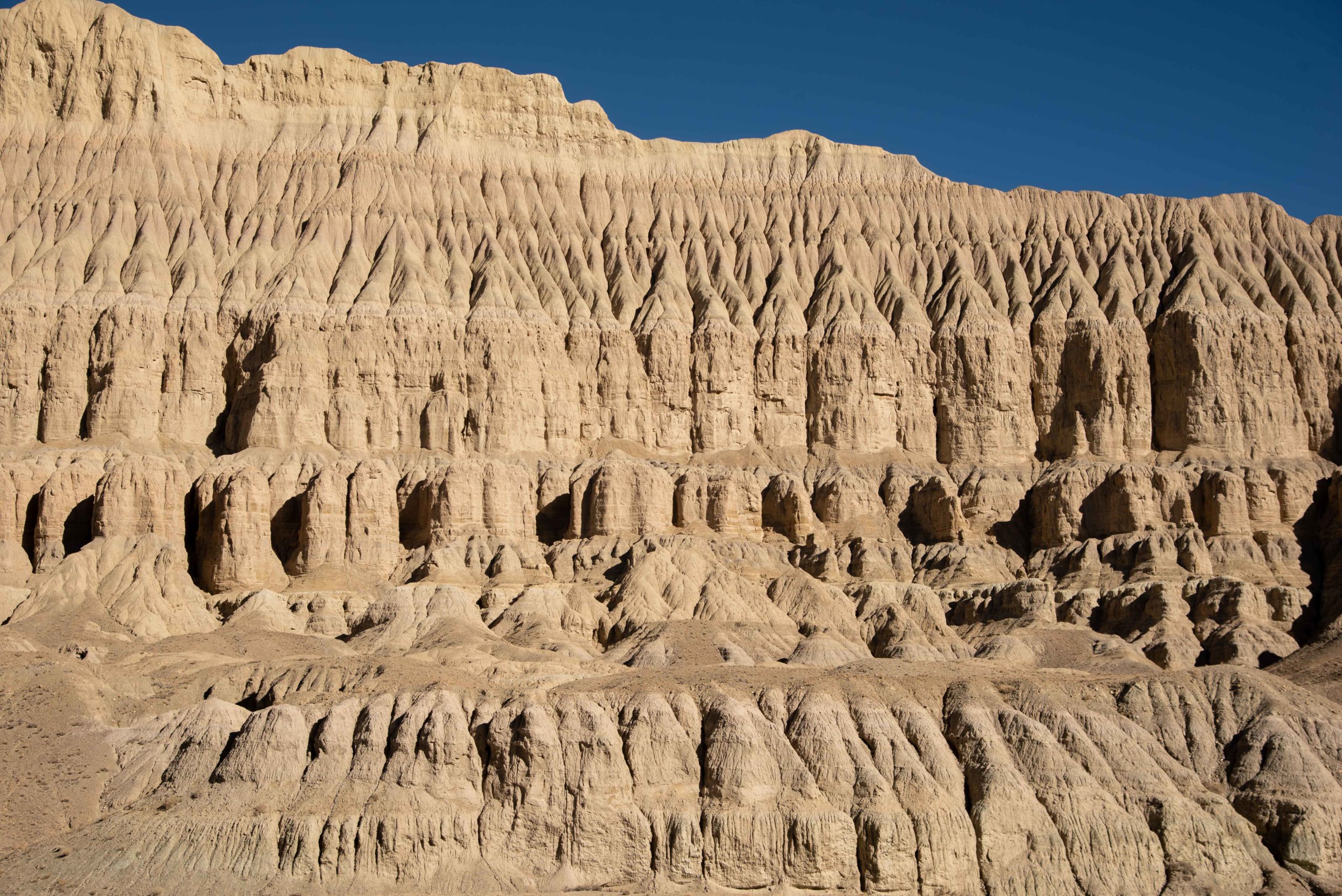
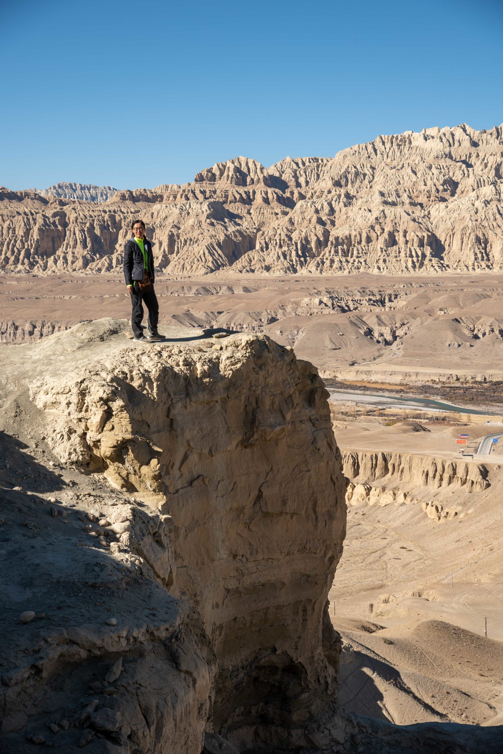
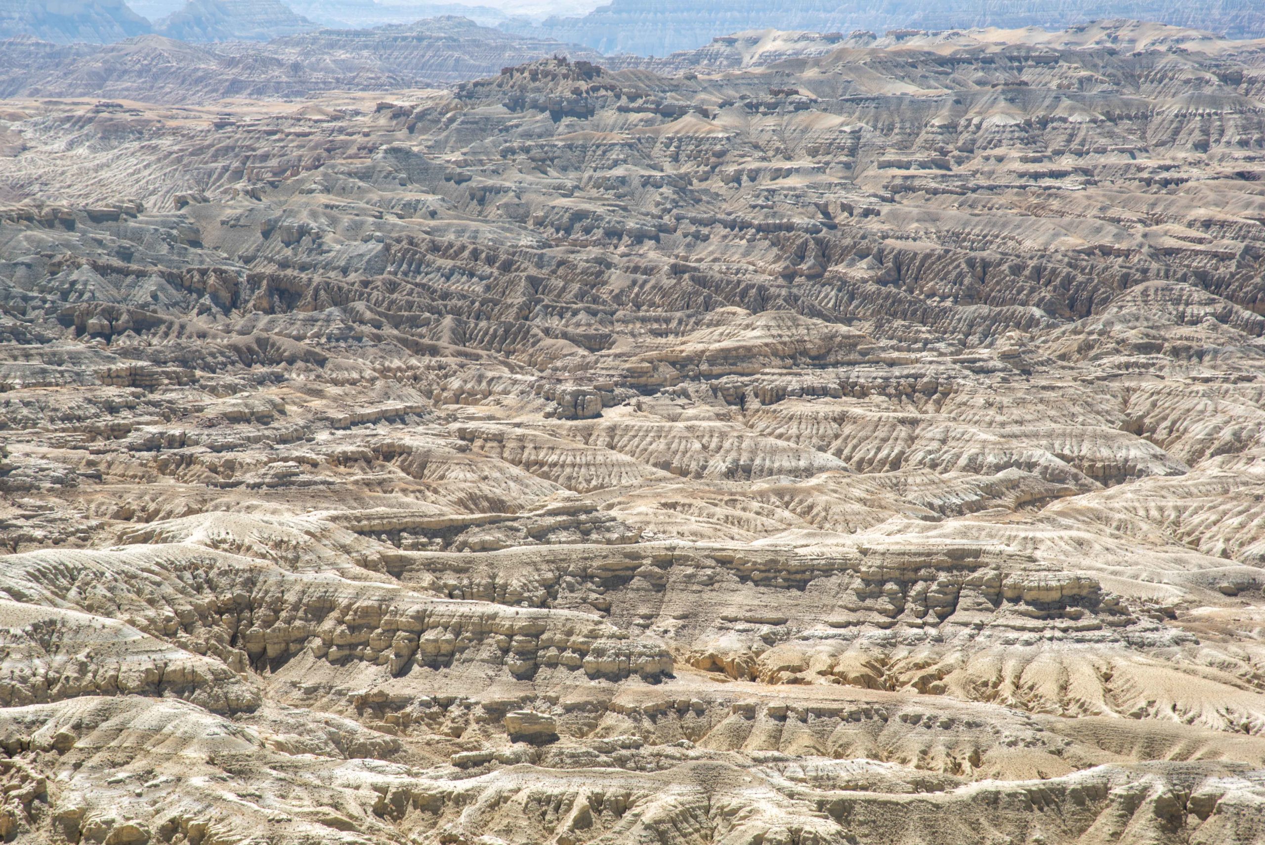
As we got close to Zanda (扎達), the landscape changed dramatically and we drove amidst the labyrinth of eroded formations across the vast plateau terrain. These striking formations are called Tulin (土林) meaning clay forest and are the results of over a million years of geological processes by wind, water and movements to the ancient great lake basin and riverbed. We were simply transfixed by the grand beauty of Nature.


The trip had finally taken a toll on me, and on the first morning in Zanda (扎達), I felt feverish and my whole body ached. I slept most of the day and could not eat but only drank warm tea with honey. My body literally shut down due to extreme fatigue. I stayed in the hotel room all day and after a much needed 24-hour rest, I felt better and was more or less back to my good self.
As I felt stronger the next day, we ventured a short trip and visited the ancient Guge Kingdom ruins (古格王國遺址). The Guge Kingdom flourished for 700 years from the 10th century to 17th century. At its peak, the dynasty extended into Kashmir (喀什米爾) and today’s Pakistan (巴基斯坦). Hence, the relics and religious murals in the monasteries show how sophisticated the culture of Guge Kingdom reached with influences from neighbouring countries.


No one knew how exactly the Guge Kingdom (古格王朝) declined and disappeared completely. Some historians believe that it was ended due to civil wars. The Guge ruins (古格王朝遺址) is an archaeological treasure and despite its much weathered and desolate state, we could not help marvelling at how they adapted to the extreme natural landscape while the physical structure of the ruins reflect the society of the time – cave dwellings at the bottom for the people, monasteries in the middle for monks and the palace at the top for the nobles and royal family.

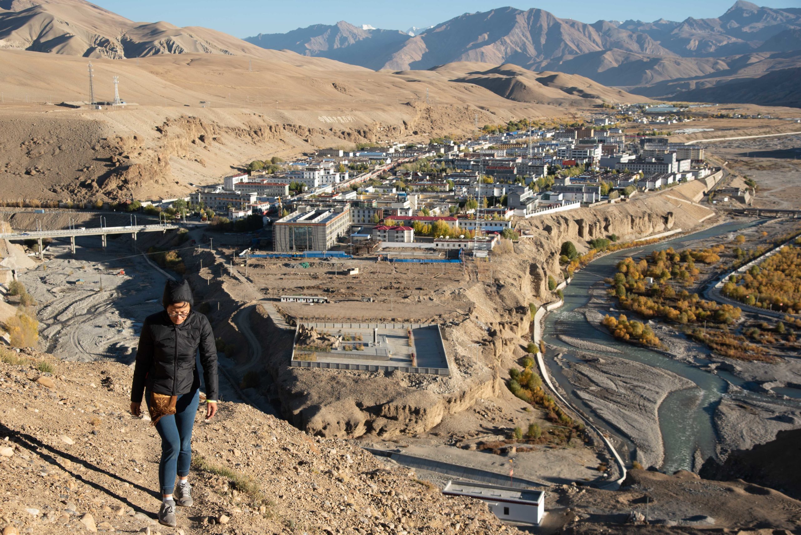
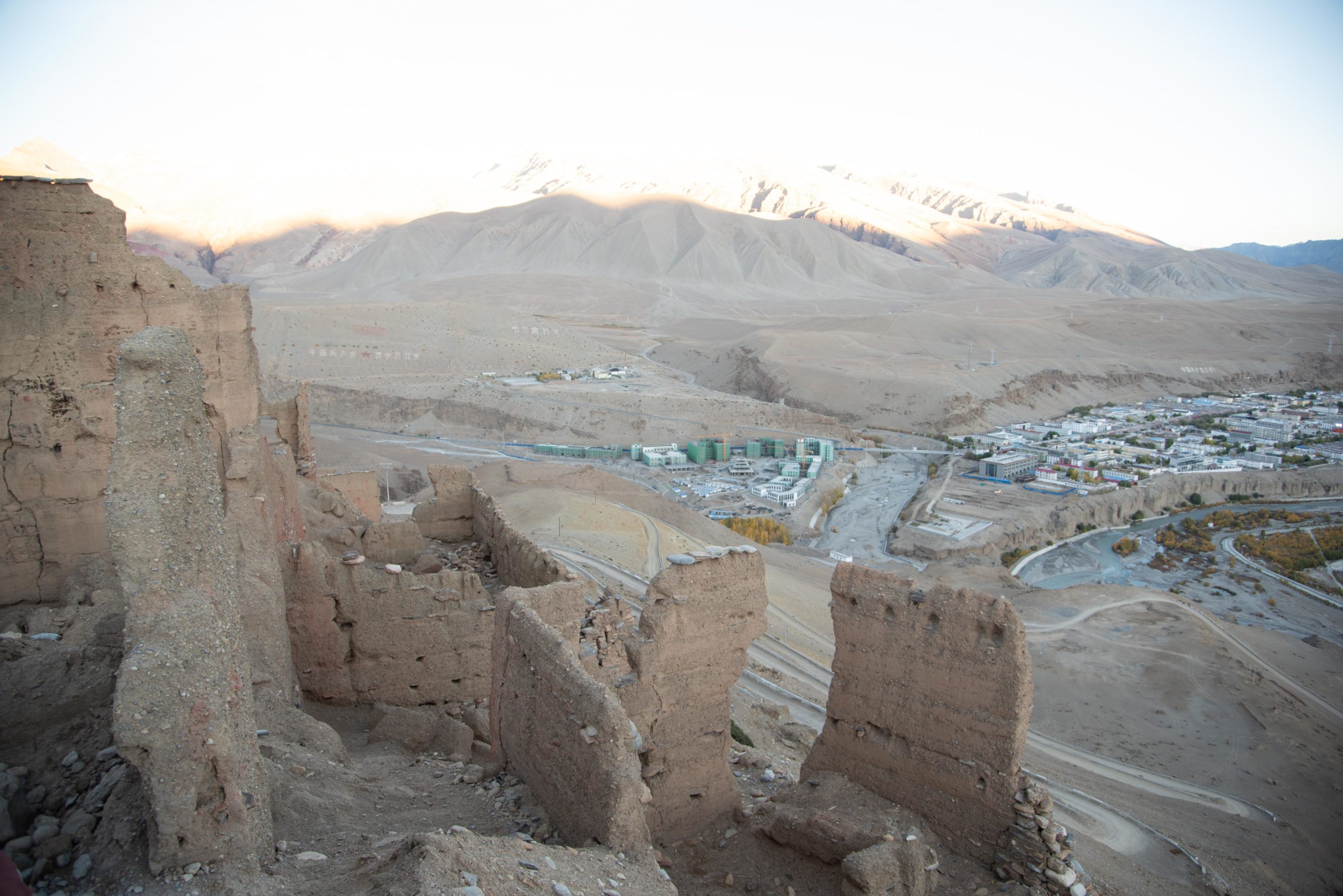
After Zanda (扎達), we drove 250 kilometres north to Shiquanhe town (獅泉河鎮) which is named after one of the major rivers which means Lion Spring. The Lion Spring River is the origin of the Indus River (印度河) which runs through Ngari prefecture (阿里), the northern tip of India (印度) and throughout Pakistan (巴基斯坦).

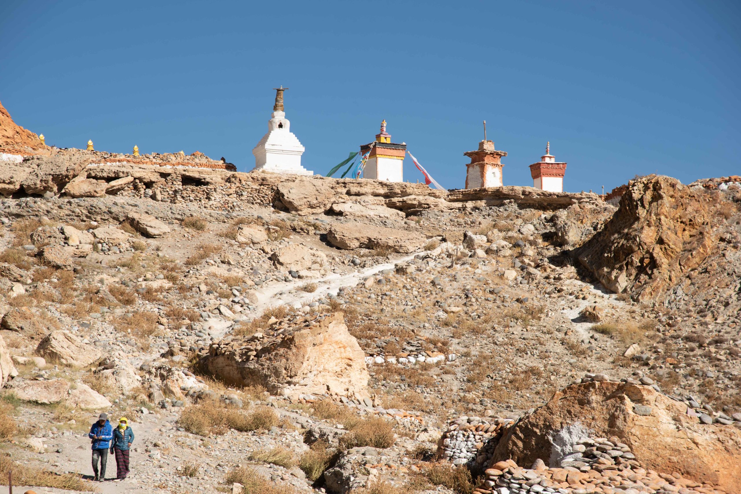
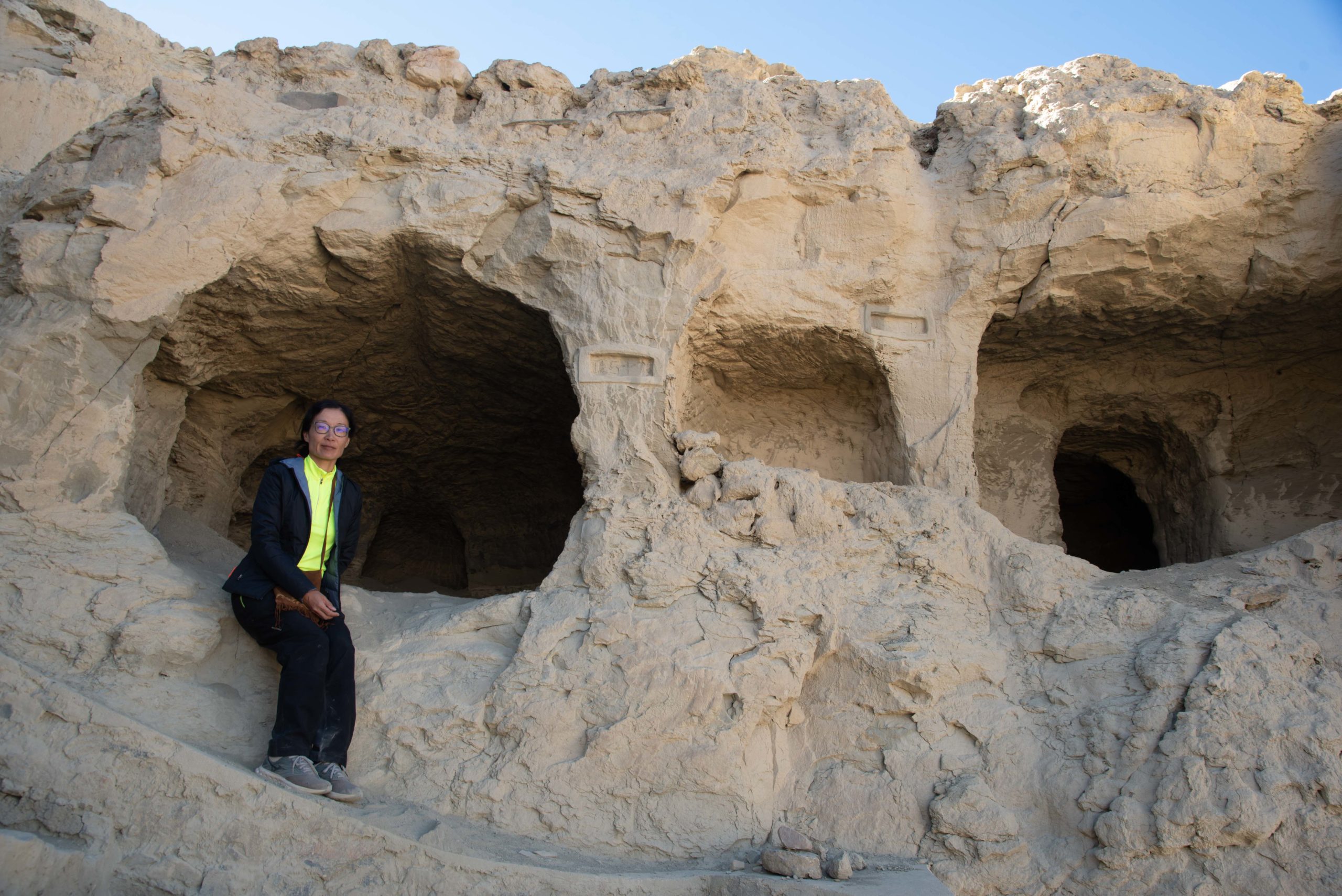
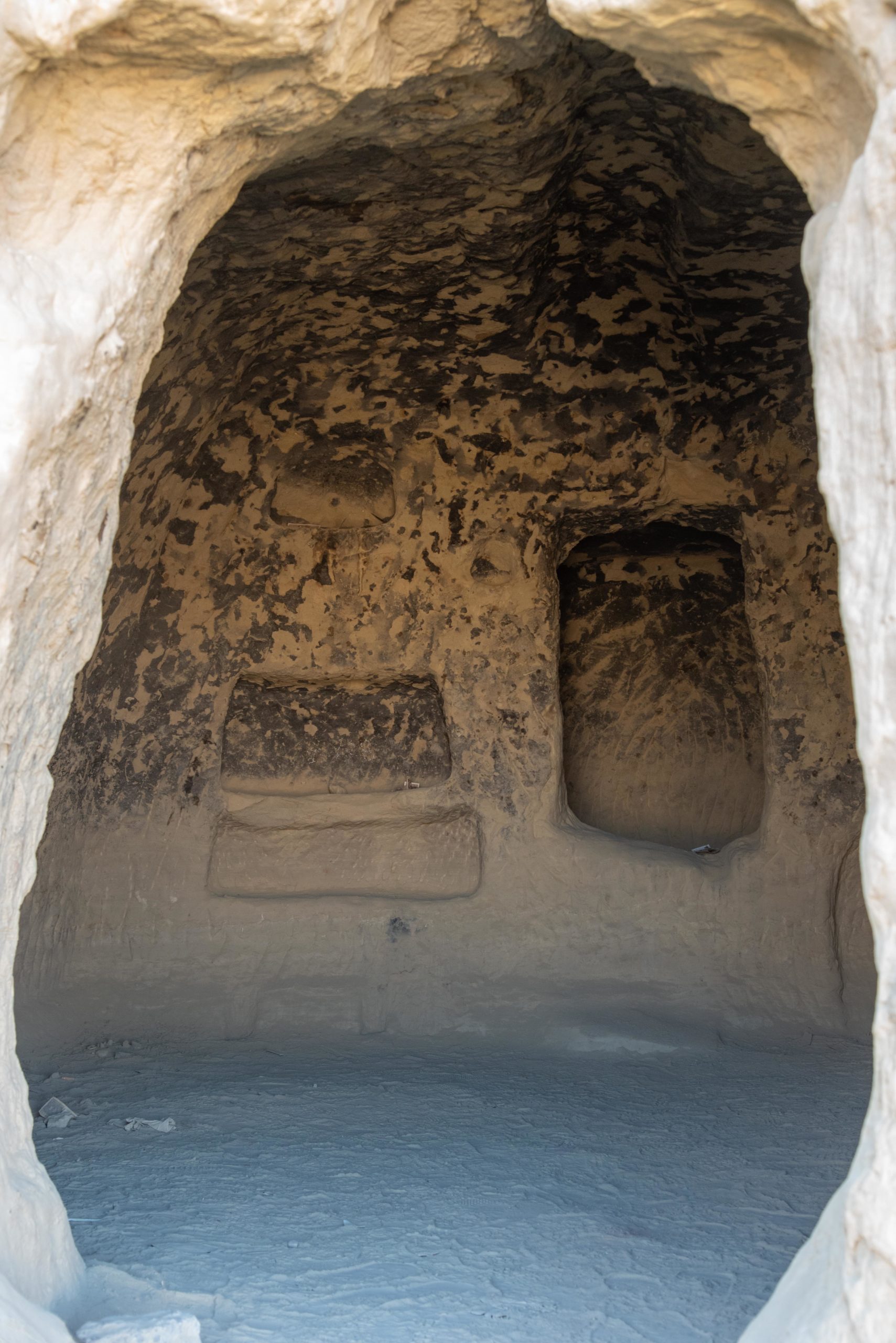
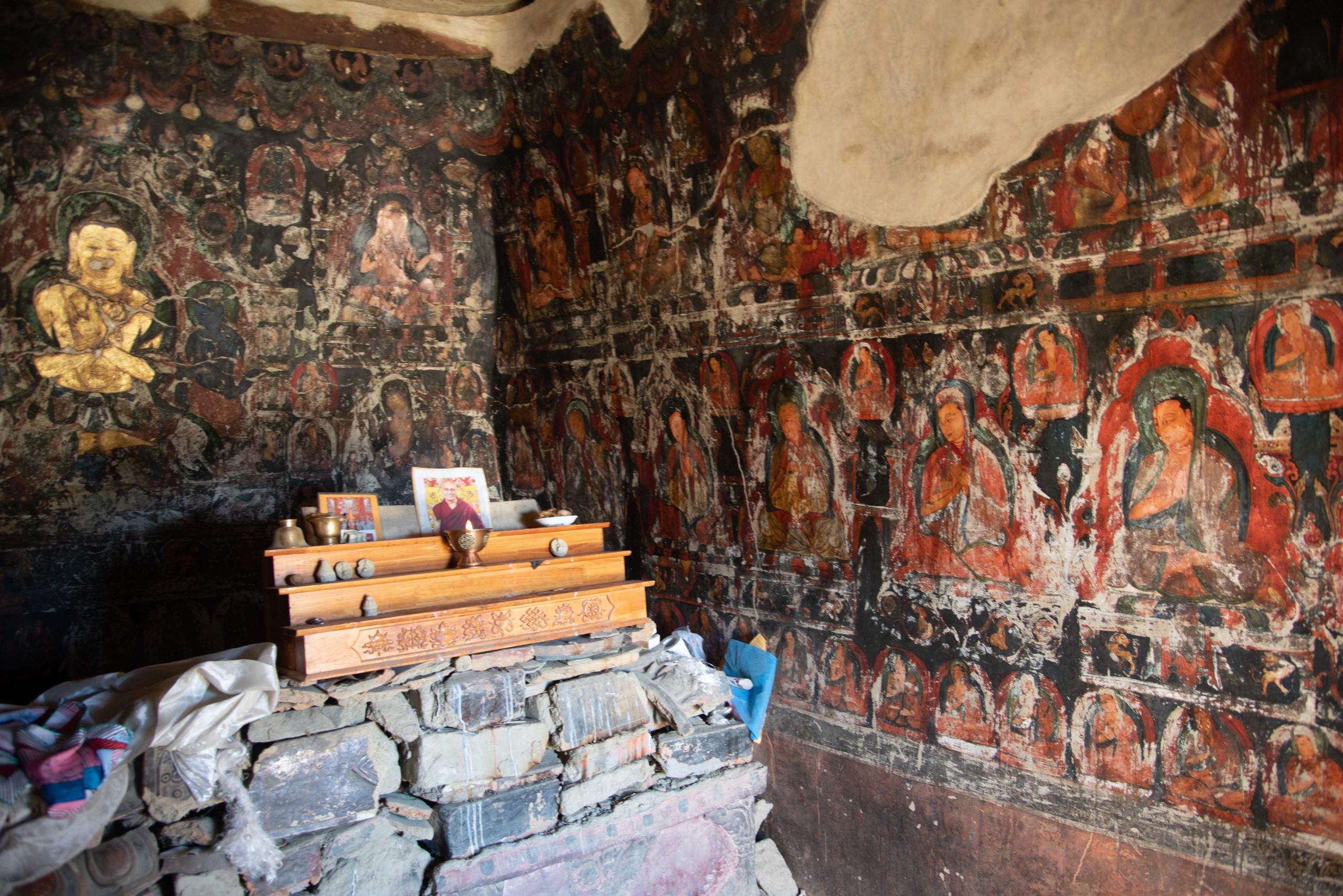
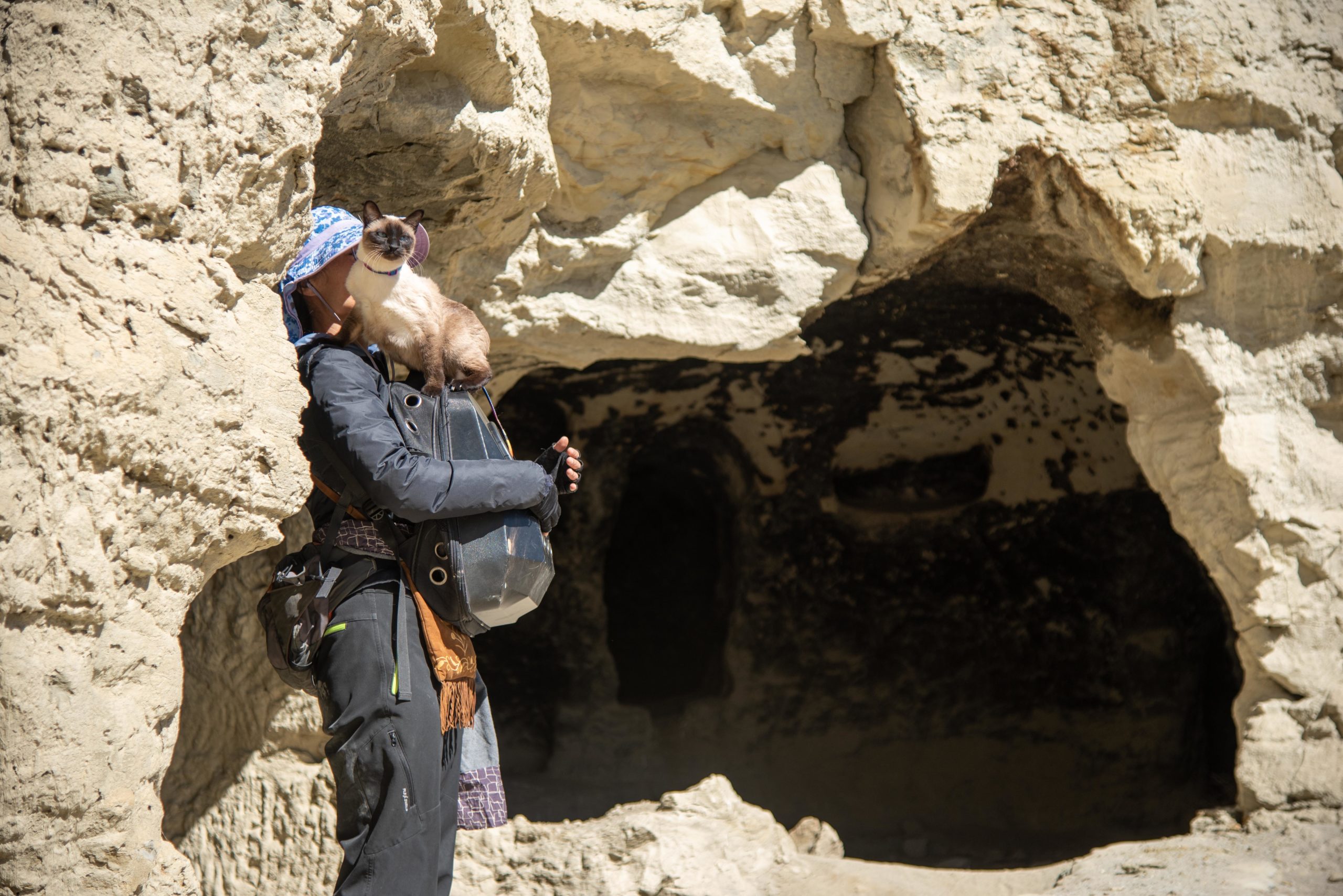
En route to Shiquanhe (獅泉河鎮), we made a little detour to the Piyang Caves (皮央石窟) which is on a hill right above a tiny Piyang village (皮央村). It is considered one of the most important cave dwellings in Tibet which, was only discovered in 1992. After we parked our van at the foot of the hill, we climbed the narrow rocky stairs and just followed the steps uphill for about 15 minutes. Then I smelled something burning and saw faint smoke rising at the far left. Adjacent to the steps, there was a tiny passageway leading to a small door at the end. I was intrigued and went through the passageway. I saw a traditional Tibetan stove on the right of the door where the smoke originated.

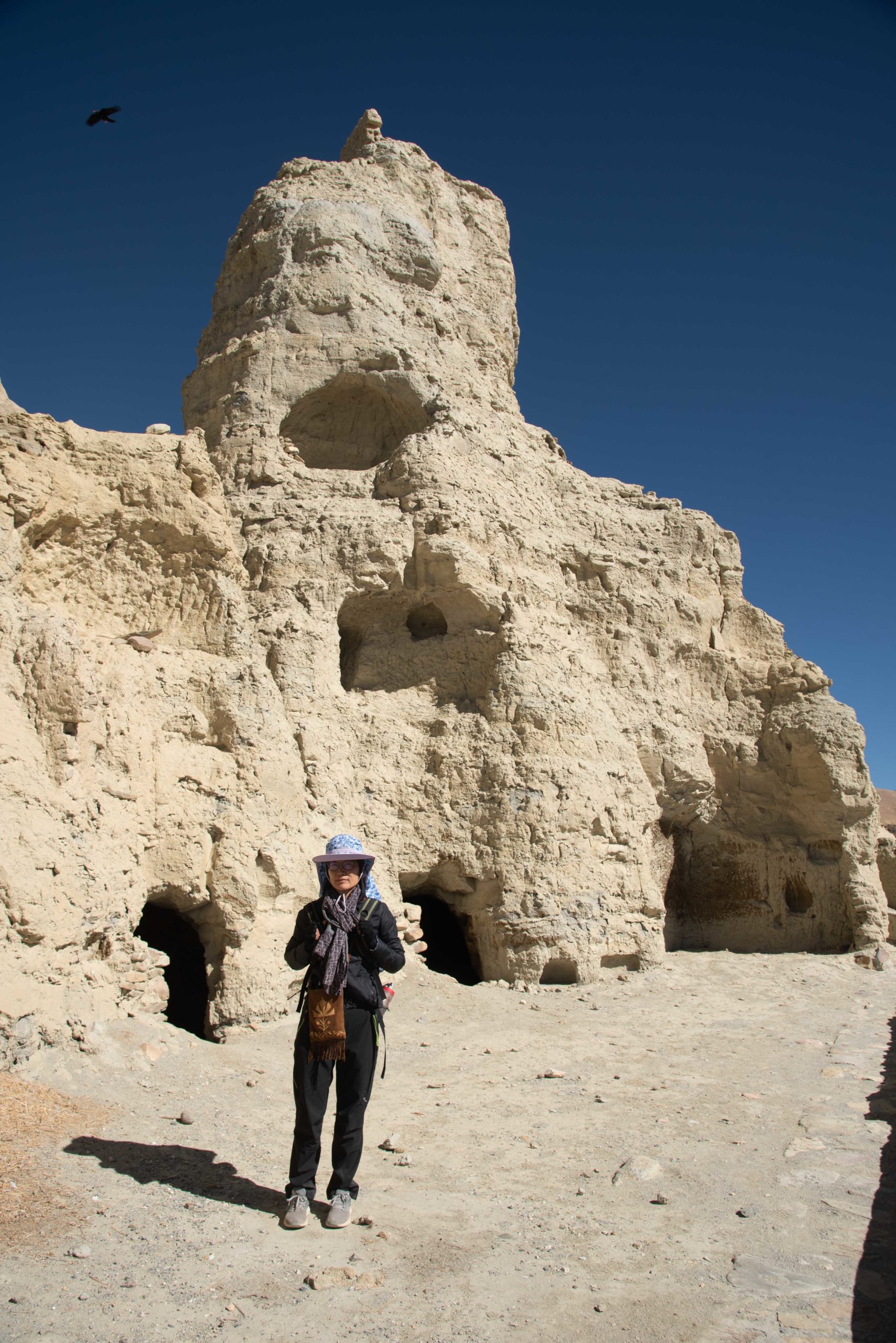
I hesitated to explore on my own and went to look for Kin who had already climbed further up the ruins. When we returned, a small and skinny old Tibetan man appeared at the door. We smiled and said hello. He smiled back and gestured us to go inside. We walked into a small dark space and saw a Tibetan bench and daily bric-a-bracs. Then he ushered us further into a completely dark cave and he held up a small torch. We followed the light of the torch upward and while our eyes were still adjusting to the dimness of the surrounding, suddenly in front of us, beautifully preserved Buddhist cave paintings appeared. The old man handed us his torch and urged us to look around the small cave. I felt as if time had stood still and we gazed at the beautiful images for some time.
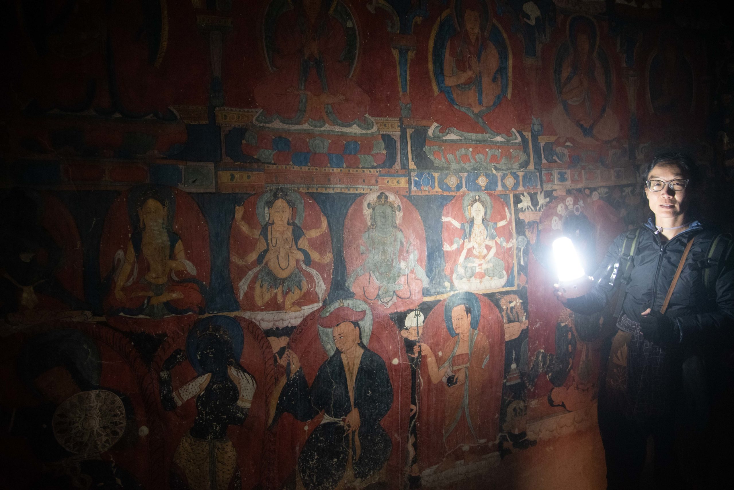
We thanked the old man and gave him some cookies we had on us. Just when we were about to turn around and leave, he grabbed a set of keys and said something and gestured us to follow him. So we followed him up the spiraling steps for a few minutes and then stopped outside a small locked wooden door. He opened it and we walked into a small rectangular cave and the interior wall was painted with elaborate patterns and different deities from the ground to the ceiling. At the far end, we saw relics stacked together. The unexpected encounter with this old man who turned out to be the caretaker of these precious caves made our time in the cave dwellings quite memorable. Seeing the remains of such a glorious past made me ponder how vulnerable we are and how human civilization can vanish or be swept away against the passage of time.

We drove another three hours and we arrived at Shiquanhe town (獅泉河鎮) in the evening. It is the capital of Ngari (阿理) and new buildings spread out from both sides of the river. We decided to stay two days and stocked up our supplies. We found a nice bakery and bought bread and cookies for the next leg of our trip. We filled up our small travelling fridge with fruits and vegetables. I even managed to buy hair oil, which I had been searching for some time when we were in Lhasa as my hair had become fizzy and extremely dry due to the arid climate.
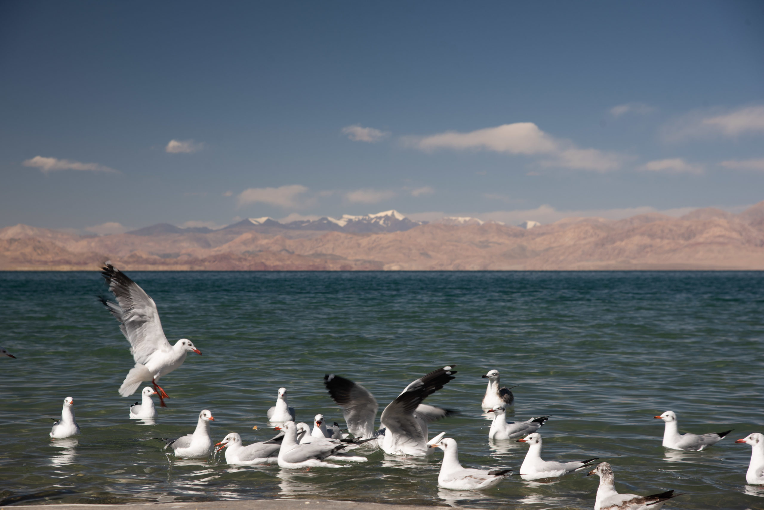
Then we headed further north to Pangong Tso (班公措) which is a huge lake at 4241 metres altitude and made up of five sub-lakes that span across western Tibet and Ladakh (拉達克) which is part of Kashmir (喀什米爾). Originally, we did not plan to go there due to the recent skirmishes between China and India at the border. But at the very last minute, a friend we met in Lhasa reassured us that it was safe to visit Pangong Tso (班公措). So off we went.


Almost half of Pangong Tso (the eastern side) belongs to China and 40% to Kashmir (喀什米爾). The remaining 10% is the disputed territory between China and India. We had seen a fair share of lakes in our trip and I must say that I like Pangong Tso (班公措) the most. I was fascinated by how the scenery and colours of the surrounding landscape changed as the lake gradually narrowed and changed shape.

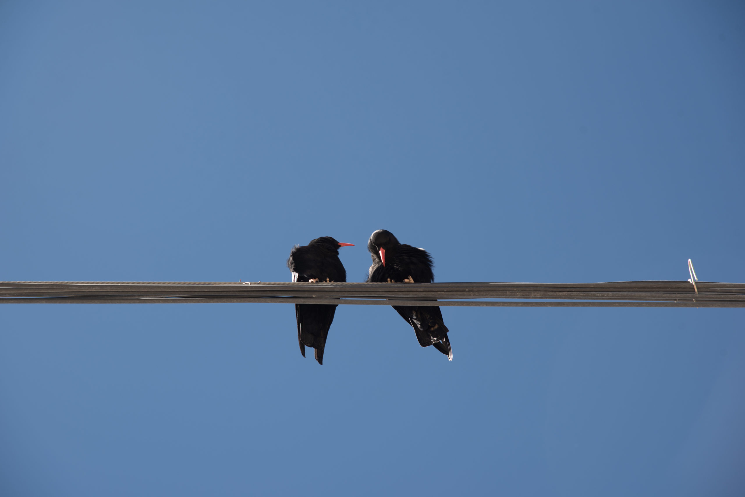
Although the bird-watching season had long passed, we were still able to see various flocks of seagulls and orange ducks (Brahmini Ducks). The seagulls were used to people and they started gathering near me by the edge of the lake waiting for me to feed them. I fed them bread and it was so fun to watch how accurately and swiftly they caught every morsel in split seconds.

If we carried on driving further north, we would enter Xinjiang (新疆). But this was the most northern point of our trip and we turned back to Shiquanhe (獅泉河) to stay one more night before we headed east towards Lhasa (拉薩). We had completed two-third of our 5,000 kilometre journey over 19 days.
10-19 Oct, 2020
hello,
Just a request for letting me use some of your Burang images in a short documentary film.
Please note that all images are copyrighted and not allowed for any other uses other than on this website.
Akie & Kin
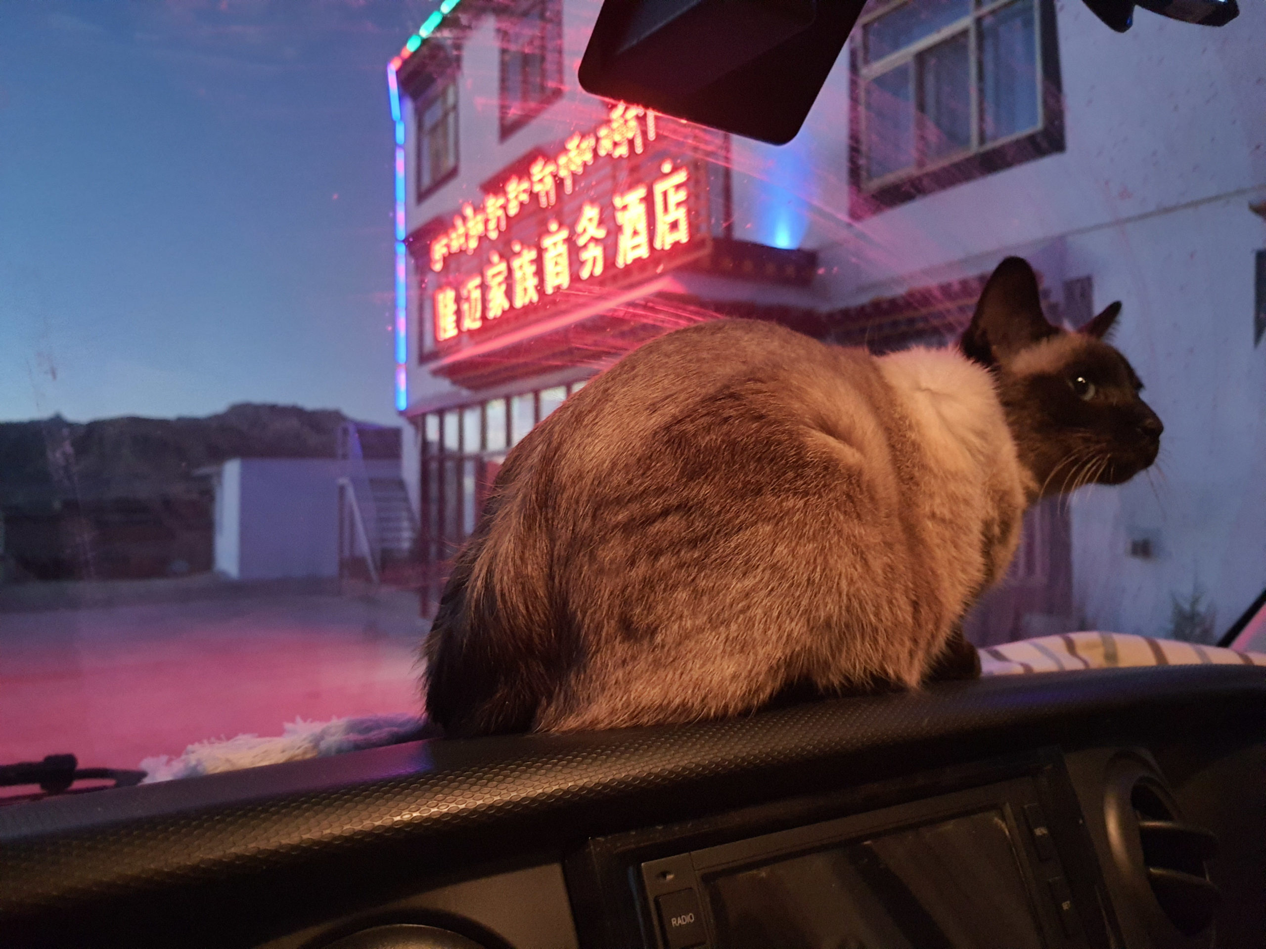
I was reading a book about Western Tibet, written in the 1990’s and came across your website. What a pleasure to find the little cave in Piyang (皮央石窟) with all the wall paintings still intact. Your pictures bring colour and detail to what is a hard land, and your journey is something I would have liked to do myself when younger – so yours will have to do for me. And, might I say, you have a very nice cat.
Richard Troughear, Central Tilba, NSW, Australia